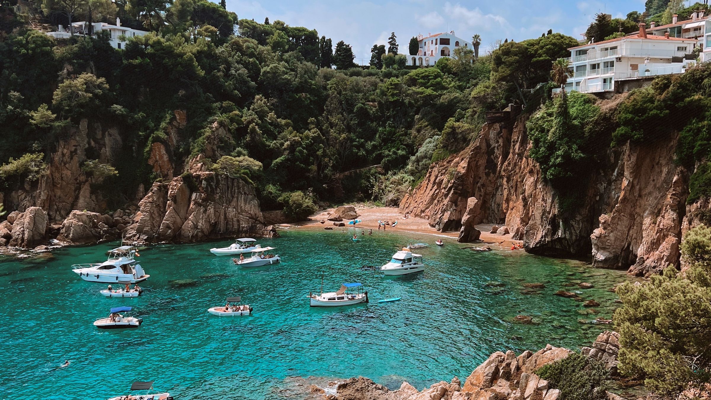
Most people's picture of Salou is a long curve of pale sand with a promenade behind it and a fountain at one end. Walk east to the end of that curve and it stops. Pines start, the ground climbs, and the shoreline breaks into a run of small bays cut out of low red rock.
That is Cap Salou: a blunt wooded headland holding six named beaches, none of which looks anything like the postcard.
A headland, not a beach resort
Geology did this. The cape is a mass of reddish sandstone that declined to erode at the pace of the softer ground on either side, so instead of sand you get short cliffs — rarely more than fifteen or twenty metres — with pockets of beach at the foot of them. Some of those pockets are barely wide enough for thirty towels.
Above the cliffs: Aleppo pines, pi blanc or white pine in Catalan, growing at the flattened angle trees adopt when they spend a century in an onshore wind. They set the colour scheme. Rust-coloured rock, dark green canopy, and water that runs from turquoise over sand to bottle green over weed within a few metres of the shore.
Clarity is the real difference. Fine sand goes into suspension with any swell, which is why the main beach so often runs the colour of weak tea; over rock, on a still morning, you can stand chest-deep at Cala Crancs and count your toes. Bring a mask — wrasse, mullet, the odd octopus in a crevice, and sea urchins in numbers that make old trainers a defensible choice on the rockier entries.
Nearest the town: Platja dels Capellans
Capellans is the transition. Two hundred metres or so of the same golden sand as Llevant, tucked in just past its eastern end, ten to fifteen minutes on foot from Passeig Jaume I. Apartment blocks stand directly behind it, which reads as either convenient or ugly depending on your mood.
Functionally it is the main beach's relief valve. When Llevant is solid in the first week of August, families push five minutes further east and land here. Shallow, sheltered by the bulk of the cape, lifeguarded in season, with showers and somewhere to eat thirty seconds off the sand.
The name means "the chaplains'" — the story locally is that clergy bathed here when the town beaches grew too public for the collar. Nobody produces a document, but as beach etymologies go it beats most.
The three coves people mean by Cap Salou
Round onto the headland proper and the beaches get smaller, prettier and considerably harder to arrive at.
Cala Crancs — crabs' cove — is the one that turns up on postcards for the cape: a hundred metres of sand in a rock horseshoe, with a slipway, a beach bar and clear water over stone at both flanks. Snorkelling here is worth the walk out. Everyone has had the same thought, which is the problem.
Cala Font sits a few hundred metres on, smaller again, with a large hotel standing over it. Sand, deep shelter, a very short walk from the road, and a permanent supply of guests who need to walk nowhere at all to fill it. By eleven in July the sand has gone.
Cala Vinya is the smallest and least built-up of the three, a scoop of coarse sand and rock reached down a flight of steps between villas. Almost no facilities, little shade, and correspondingly fewer people until around noon.
Be realistic about size. These are coves, not beaches, and they fill in the order you would expect — nearest the town first, from about ten in the morning. Several involve a staircase down from the road, which rules them out with a pushchair or a bad knee. And parking near Cala Font or Cala Crancs on an August morning is not so much difficult as futile: residents take the kerbs by nine, and the streets up here are narrow, one-way and unforgiving.
Up at the lighthouse
A squat white lighthouse marks the point — working, unromantic, closed to visitors. It has been showing a light since the middle of the nineteenth century, when the traffic along this coast was schooners out of Tarragona rather than charter flights into Reus.
You come for the terrace beside it rather than the building. From the railings the bay opens west toward Cambrils, and on a clear evening the light across the water explains the name the tourist boards settled on for this coastline: the Costa Daurada, the golden coast. Ten minutes, a bench, no ticket.
The cape is the part of Salou that was here before Salou was a resort — and the only part of it where you can stand and see none of the resort at all.
Where the pines come down: Llenguadets and Platja Llarga
Past the point the coast opens out again. Platja dels Llenguadets — sole beach, after the flatfish — is a hundred-odd metres of soft sand in a shallow bowl, sheltered enough that small children can be let loose in the water. Shade at sea level is another matter; the trees stop at the top of the bank.
Platja Llarga is the exception out here: five hundred metres of sand, the only beach on the cape with room to breathe. Behind it stands a genuine pinewood, and under the pinewood a car park that by mid-morning in August is the most contested real estate in the municipality. Facing open water, it picks up swell — small waves, usually welcome, occasionally enough to matter with toddlers.
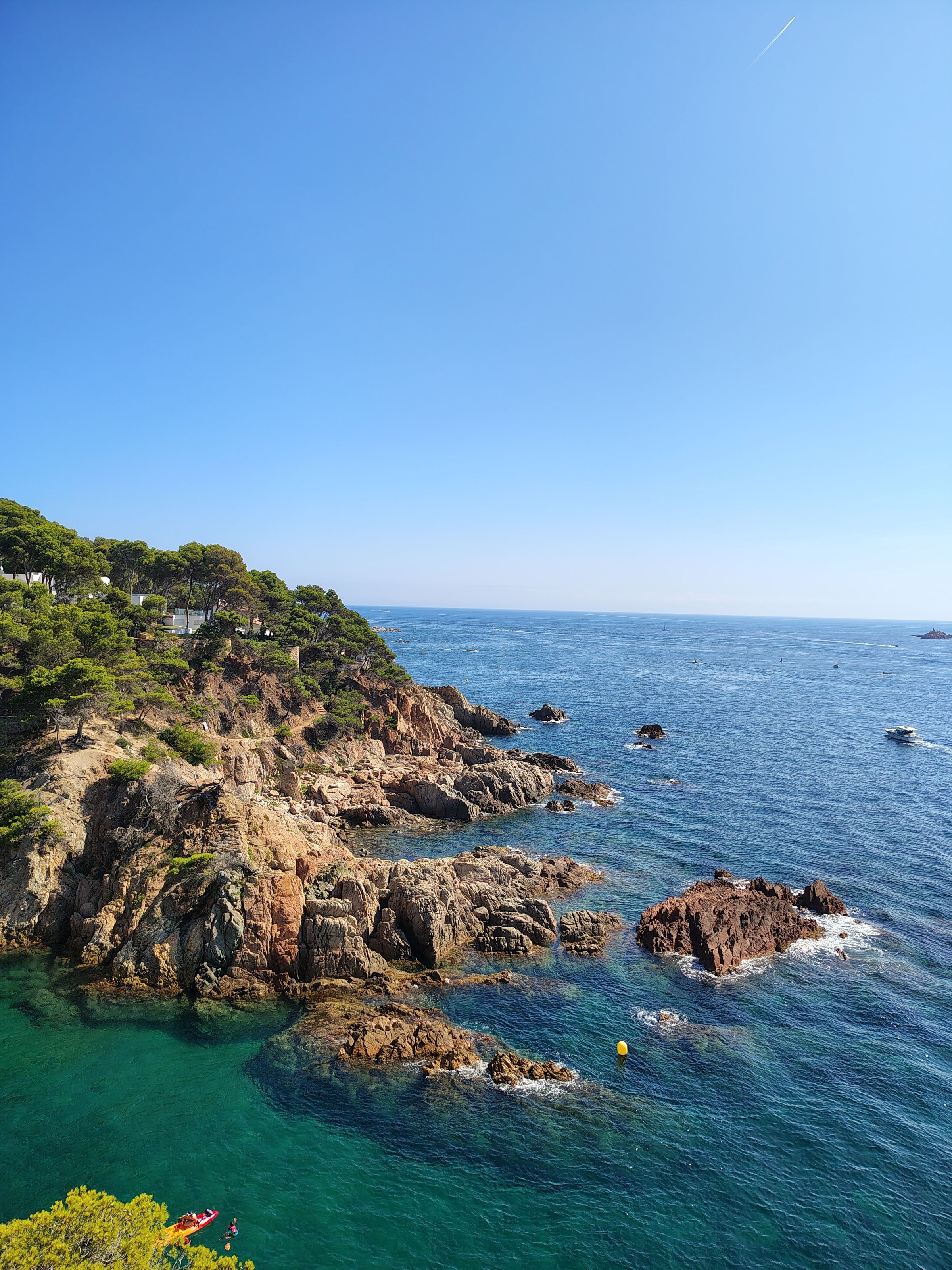
The cape rewards odd hours. Before half past ten the coves are cool, still and half empty; from five they clear again as families head back for dinner, and the light on the red rock is at its best. Between eleven and four in high summer, go to Llevant instead — it has the space for it.
Walking the whole thing
A camí de ronda — the Catalan tradition of clifftop paths, originally cut so customs men could watch for smugglers — links most of this together. From the end of Llevant round to Platja Llarga is near five kilometres, and about an hour and a half if you never stop, which you will.
Nobody should mistake it for a wilderness trail. Parts are boardwalk and railings, parts are steps, and in two or three places private frontage pushes you onto residential streets for a few hundred metres before dropping you back to the sea. Signposting is decent rather than continuous.
- Walk it early or late; the exposed sections carry almost no shade.
- Trainers, not flip-flops — the steps are frequent and some are worn smooth.
- Carry water. Coves with bars are the busy ones; the quiet ones have nothing.
The coves, compared
| Beach | Size | Sand and water | Getting in | Full by |
|---|---|---|---|---|
| Platja dels Capellans | About 200 m | Fine gold, shallow, sheltered | Level, off the promenade | Mid-morning in season |
| Cala Crancs | About 100 m | Sand, rock at both ends | Ramp and steps | Ten in the morning |
| Cala Font | Under 100 m | Sand, very sheltered | Short steps from the road | Eleven; hotel guests first |
| Cala Vinya | Smallest of the six | Coarse sand and rock | Long flight of steps | Around midday |
| Platja dels Llenguadets | About 100 m | Soft sand, shallow bowl | Steps, pines above | Midday |
| Platja Llarga | About 500 m | Sand, open, some swell | Level, through the pinewood | Car park first, by ten |
Should you stay out here?
Plenty of Salou's quieter hotels and apartment blocks sit on the cape, and the pitch is an honest one: pines outside the window, a cove three minutes down the steps, and none of the noise off Carrer Carles Buïgas.
What you trade away is everything walkable. Dinner means twenty to thirty minutes back into town, uphill on the return, or the seasonal road train while it runs. Restaurant choice up here is thin and largely hotel-tied, and in April or October, with half the businesses still shuttered, the cape can feel deserted. Weigh that against the noise you are escaping — the note on where to stay takes the same question resort-wide.
None of this replaces the main beach, and it is not meant to. The cape is where you go on day three, once the promenade has stopped being new; buses and the road train run out this way in season, covered in moving around Salou. Beach-by-beach detail comes from the Salou tourist board and the town council; the coastline either side is covered by the Costa Daurada tourist board.